Features
Air Traffic
Approaching with WAAS
After one hundred years of powered flight in Canada, the disparity that remains in navigation avionics is intriguing.
February 8, 2010 By James Marasa
After one hundred years of powered flight in Canada, the disparity that remains in navigation avionics is intriguing. On the roads today, as vehicles are guided turn by turn to the nearest coffee shop by dash-mounted GPS units, it is a wonder that aircraft are still flying non-precision approaches based on VORs and NDBs, armed with a mere approach plate and stopwatch to determine their distance from the runway threshold. It is with some irony that, upon landing, pilots may phone in their arrival report with a mobile smartphone packing more navigational chutzpah than the instruments used in flight.
 |
|
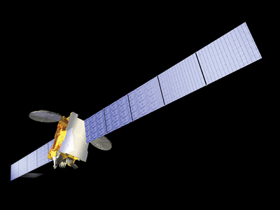
| Telesat Canada provides WAAS service from its Anik F1R satellite, while Nav Canada maintains the nation’s four monitoring stations.
|
That being said, most pilots would opt to shoot a precision approach (traditionally an ILS) over any non-precision alternative. A precision approach simply offers superior situational awareness during the most critical phase of flight due to the vertical dimension of guidance it provides to the decision height. Not surprisingly, enhanced situational awareness comes paired with added safety as a 2003 article in Flight Safety Digest reported that commercial operators were five times more likely to suffer an accident during a non-precision approach than during a Category-I ILS.
Traditionally, VOR radials and NDB tracks have comprised the majority of instrument approach procedures in Canada. However, due to the geographical placement of the ground-based navaids, the approach is often designed in favour of one runway, meaning that if the winds align with a non-instrument runway, a circling procedure may be required.
Ed McDonald, a 16,000-hour veteran of the military and civilian airlines believes that the latest GPS technology is offering a viable alternative to the non-precision/circling approach. “Can you imagine a worse set of circumstances to be flying in?” he asks. “You have the gear and the flaps down, flying at slow speed very close to the ground in poor visibility…”
Accident statistics pose no challenge. A study of UK Civil Aviation Authority (CAA) approach and landing accidents (ALA) reveals that from 1980-1996, 75 per cent of ALAs occurred while a precision approach aid was not available or not being used.
“I began to see the application that GPS could have in 1994,” says McDonald, then a pilot with Canadian Airlines. Seven years ago, armed with the insight of the possibilities that GPS held for aviation, McDonald founded JetPro, an Alberta-based engineering firm that designs GPS approaches throughout Canada. Today, McDonald is pioneering a new kind of approach design made possible by Transport Canada’s October, 2005 approval of the “Wide-Area Augmentation System” commonly known as WAAS.
 |
|
| JetPro's Ed McDonald gets into his company jet.
|
Developed by the FAA to enhance the integrity of the standard GPS signal, WAAS employs two Geo-stationary satellites and a network of ground-based monitoring stations deployed throughout North America. WAAS effectively corrects the errors inherent in GPS due to timing, satellite orbit and refraction through the ionosphere. The corrections are then sent to the Geo-stationary satellites, which relay the information to WAAS receivers. The receiver then decodes the information and applies the correction to each GPS satellite being used in the navigation solution. Telesat Canada provides WAAS service from its Anik F1R satellite, while Nav Canada, which has worked jointly with the FAA in bringing WAAS to Canada, maintains the nation’s four monitoring stations.
As a result, GPS accuracy improves to plus or minus one metre horizontally and vertically. This enhanced precision allows for the possibility of lower approach minimums and the addition of an exciting new element to the realm of GPS approaches: a glide slope. Technically referred to as “Localizer Performance with Vertical Guidance” (LPV), WAAS has enabled ILS-like approach capability without the requirement to install or maintain ground-based navaids.
As WAAS remains a relatively new concept, McDonald admits he is often met with confusion when he explains the business of JetPro. When he presents the advantages of WAAS to municipalities and airport operators around the country, much of his audience is surprised to hear that Transport Canada is not implementing the approaches for its airport. In fact, Transport Canada has not designed an instrument approach procedure since 1996, when Nav Canada acquired control of the nation’s air navigation system. All subsequent instrument approaches have been designed by Nav Canada or commercial designers such as JetPro, with Nav Canada maintaining the sole legal responsibility for publication of the completed design packages. To date, JetPro alone has designed GPS and WAAS approaches at over 60 Canadian airports and 120 runways, comprising roughly two-thirds of all WAAS approaches currently implemented or in the queue for publication.
In addition to its well-documented safety benefits, McDonald believes that the social and economic benefits of WAAS stand to be tremendous. “Ultimately,” as he says, “economics is the primary driver of innovation.”
Prior to the introduction of WAAS, McDonald claims that several municipalities would have leapt at the chance to develop precision approaches at the airports serving their communities. Lower approach minimums means better airport access and could, at times, mean the difference between a medevac aircraft carrying a critically ill patient completing its mission or diverting to an alternate airport. Unfortunately, the $1.5M price tag on ILS equipment has been prohibitive for many smaller airports. However, as WAAS eliminates the need for ground-based equipment and its associated installation and maintenance costs, McDonald suggests that precision approaches may now be available to airport operators who could not have otherwise afforded an ILS.
Three years ago, when Lloyd Epp, director of flight operations at Saskatchewan-based West Wind Aviation, came across WAAS, he immediately saw the potential impact it could have on his operation. “We had spent enough time sitting on the ground with a 400-foot ceiling that we were confident the monetary cost to implement WAAS was going to have a pretty quick payback.”
 |
|
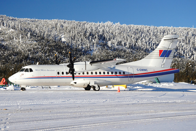
| For West Wind Aviation, WAAS approaches have meant better access to airports serving the uranium mines of Northern Saskatchewan.
|
As one of Western Canada’s largest charter operators, West Wind regularly ferries workers in and out of the burgeoning uranium mines of Northern Saskatchewan. Immediately prior to introducing GPS approaches, Epp explains that approach minimums at Cigar Lake, one of the prominent airports serving the region, used to sit at roughly 600 feet. After a circling NDB approach, aircraft would often “break out” at a 90-degree angle to the runway. When the possibility of straight-in GPS approaches presented itself, Epp says they welcomed the progression and were quick to take advantage of them.
“When (JetPro) got involved, they designed straight-in GPS approaches to both runways. That brought the interim minimums down to roughly 400 feet.”
On Oct. 22, 2009, the new WAAS approaches at Cigar Lake were published, lowering approach minimums once again, and marking a giant step forward in the evolution of the airport. On day one, with ceilings hovering between 250 and 300 feet, West Wind’s ATR-42s, armed with WAAS-enabled GPS receivers, taxied out, eager to make full use of them.
“The first day the (WAAS) approaches were available,” says Epp, “our chief pilot was going out to Cigar Lake to do a line-indoctrination and fly the approaches for the first time… had it not been for WAAS, he would have had to wait on the ground.”
Epp is adamant that given the type of work that West Wind does, the impact of the new approaches will be huge. “The day WAAS approaches became available at Cigar Lake,” he says “a significant amount of safety was added to the process.” Unlike a scheduled airline which may cancel flights due to weather, West Wind needs to make every flight happen or workers are left in the camps away from their families, shortening their time at home, and extending overtime hours which can add substantially to labour costs. “If we have thirty flights to do in a week” says Epp “and we can’t do one because of weather, it still needs to happen eventually.”
Upon hearing the news of West Wind’s first date with WAAS, Ed McDonald was ecstatic. “In five to 10 years,” he says, “airplanes will be flying RNAV direct from A to B, and linking up with a straight-in WAAS approach.”
With en route GPS tracks now commonplace in commercial aviation, are approaches destined to follow suit? While the ILS is not yet expected to be phased out completely, it isn’t far-fetched to anticipate continued expansion and application of WAAS technology if stories such as Epp’s begin to echo through the industry. Further evolution of GPS could mean that VORs and NDBs are reduced to relics of a bygone age as operators awaken to the added safety and cost-effectiveness that a modern GPS/WAAS operation can provide. If McDonald’s vision is accurate, that day may come sooner rather than later.
“WAAS is here,” says McDonald. “It’s no longer coming, it’s here.”